


On a narrow hilltop in southern Uzbekistan, some 20 meters above a small oasis valley, archaeologists have found what they believe is a rare and short-lived trace of the Greek-speaking world that outlasted Alexander the Great by more than a century, a military camp built on the contested border between ancient Bactria and Sogdiana.
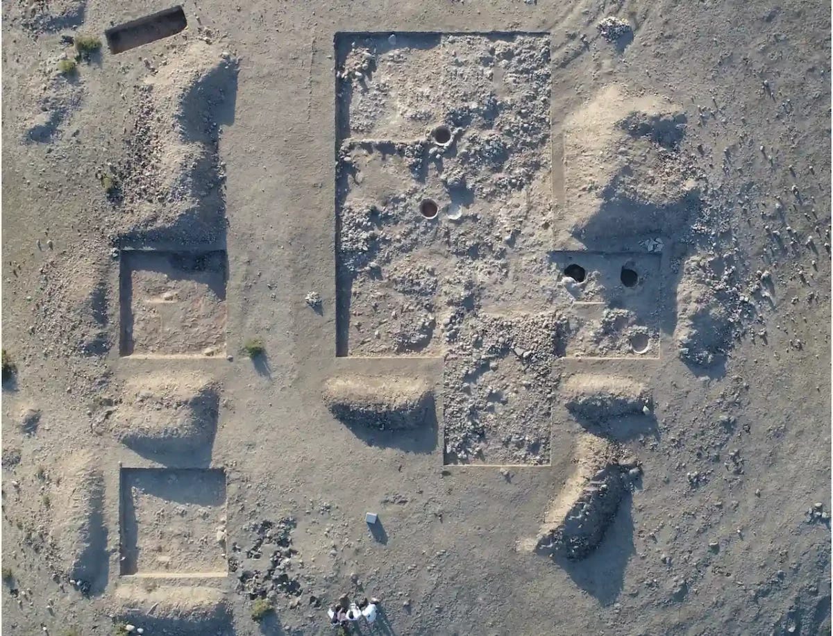
Excavations at Iskandar Tepa. Image credit: Ladislav Stančo et al. (2022).
The site, called Iskandar Tepa, sits in the Sherobod District of Surkhan Darya Province, near the Loylagan valley, commanding a clear view of the surrounding oasis landscape. New geophysical survey work, combined with targeted excavation, has overturned the site’s earlier identification as a modest rural settlement, revealing instead a fortified, short-term encampment from the Hellenistic period.
The research, led by Ladislav Stančo of Charles University in Prague working with a Czech-Uzbek archaeological team, is published in the Journal of Archaeological Science, Reports.
From village to garrison
The site was first surveyed in 2017, but it was the team’s return in 2021, equipped with magnetometry and ground-penetrating radar, that transformed the picture. The scans revealed a camp area of nearly six hectares, encircled by a defensive ditch stretching roughly 400 meters and enclosing a core area of about 1.2 hectares. Excavation later confirmed the ditch measured four to seven meters wide and up to 85 centimeters deep, cut with a stepped profile, and accompanied by postholes suggesting a wooden palisade rather than any permanent stone or mudbrick fortification.
That combination, an elevated position, a circular defensive ditch, and the conspicuous absence of solid buildings, is precisely what led Stančo to the camp identification. He noted that this pattern matches historical descriptions of Greek military camps closely, a type of site only rarely documented anywhere in Central Asia, and that the find demonstrates just how effective geophysical survey can be in dry, poorly preserved landscapes where almost nothing is visible on the surface.
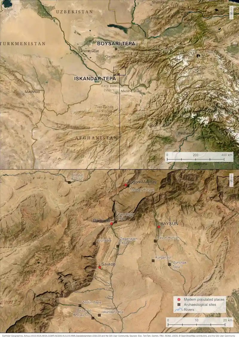
Map of the Bactro-Sogdian borderlands showing Hellenistic and Transitional period settlements. Credit: L. Stančo and T. Tencer.
Water carried up the hill
Inside the enclosure, excavators found large ceramic storage jars known locally as khums, buried directly into the ground. Three were fully excavated and showed traces of white mineral crusts, residue the team believes came from stored water rather than from grain or other foodstuffs. Since no permanent buildings or water source were identified anywhere at the site itself, researchers believe the jars held water hauled up from the valley below or drawn from a nearby canal identified during the survey, logistics consistent with a temporary garrison rather than a settled village.
Coins that fix the date
Dating the camp fell largely to numismatics. Coins recovered at the site, including issues of the Greco-Bactrian kings Euthydemus I and Demetrius I, point to occupation mainly during the second century BC, with the possibility of some continuation into the first century BC. That places Iskandar Tepa within the Hellenistic world that persisted in Central Asia long after Alexander’s own campaigns, when Greco-Bactrian rulers controlled swaths of the region and maintained military outposts to secure valleys, routes, and contested frontier zones.
The Alexander connection in the site’s name is more symbolic than direct. The camp itself was almost certainly not used by Alexander’s own army, since it postdates his campaigns by roughly a century. Its real significance lies in showing how the Greek military and political framework his conquests established in Central Asia continued to shape the region for generations afterward, long after Alexander himself had died.
A borderland with a wider system
Iskandar Tepa was not an isolated position. Researchers compared its layout directly to Boysari Tepa, a similarly shaped hilltop site in Sogdiana, which shares the same basic template, a shallow encircling ditch and simple wooden postholes rather than permanent architecture. Earlier work by Stančo’s team had already proposed that Iskandar Tepa belonged to a wider system of outposts and watch-posts maintained by the last Greco-Bactrian rulers specifically to control the Sogdian-Bactrian borderlands and the communication routes running through them, a network that also included the well-documented fortress of Kurganzol guarding the mountain passes between the two regions, and the more recently excavated fortress at Uzundara nearby.
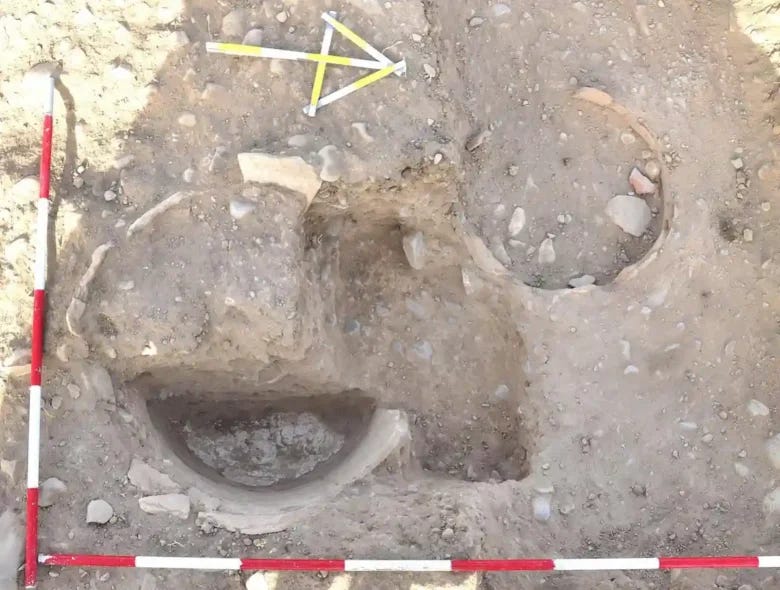
Iskandar Tepa, trench IT21-03/04. Khum vessels B (right) and C (left). Credit: J. Kysela.
A hilltop that outlived its garrison
The military phase was not the end of the hill’s story. Around its edges, the survey detected close to 90 oval pits, clustered mainly along the eastern and western margins of the site. Excavation confirmed these as burial pits, some dating to the first century BC and later, well after the camp’s active military use had likely ended. A handful of these graves overlap directly with the settlement area itself, suggesting that once the garrison moved on, the hilltop continued to serve the surrounding community as a burial ground for a considerable time afterward.
Earlier research by the same team had also identified a subsequent phase at the site, in which newly arrived semi-nomadic groups took control of northern Bactria during the second half of the second century BC, occupying the same hilltop after the Greco-Bactrian military presence had faded, a reminder of how quickly political control could shift along this contested frontier in the wake of Alexander’s fractured Hellenistic inheritance.
Source. Stančo, L., Kysela, J., Tencer, T., Milo, P., and Shaydullaev, S. (2026). “Geophysical and Archaeological Survey of the Hellenistic-Period Settlement Iskandar Tepa in the Bactro-Sogdian Borderlands.” Journal of Archaeological Science, Reports, 72, Article 105742. doi.org/10.1016/j.jasrep.2026.105742
Iskander Tepa isn't even in the Ferghana. Wow. He left defenses in depth everywhere.